Limavady Maps - District Map Limavady Northern Ireland
Useful road map of Limavady district, town centre and surroundings.
View Larger Map |
||
 |
||
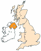
Local District Street Map for Limavady County Londonderry Northern Ireland
Limavady Maps: With this easy to print map, you can see local districts of Limavady, its central area and surroundings within the county of County Londonderry, Northern Ireland in the United Kingdom. Using this detailed Limavady map, you can find your way around the town and locate streets, roads and facilities in Limavady. The view of the map shown on this page is of the town centre area of Limavady, use the minus ( - ) button (bottom right of map) to view districts and surrounding areas, villages, towns and points of interest. Limavady district map. By viewing this map you can judge roughly how far Limavady is from these nearby places and see the distance between.
Things you can view include: Rossmar Special School, Roe Valley Education Forum, Limavady High School, Roe Valley Country Park, Main Street Limavady, The A371, The A37 (Downland Road), The River Roe, Limavady Baptist Church, St Marys Church, Drumachose Primary School, Enagh Cemetery, St Marys School Limavady, Roe Valley Leisure Centre, The Alexander Arms Pub, North West Regional College, Limavady Grammar School, Limavady Borough Council, Limavady Health Centre, Limavady Cricket & Rugby Football Club and more (you may need to utilise "view larger map link").
Northern Ireland Maps: Limavady, County Londonderry street map. Printable map of Limavady Northern Ireland.
Limavady districts, Limavady streets, Limavady roads, Limavady attractions.
More Local District Maps:
- Detailed Map Ballyclare District Northern Ireland
- Detailed Map Dungiven District Northern Ireland
- Detailed Map Maghera District Northern Ireland
- Detailed Map Ballymena District Northern Ireland
- Detailed Map Warrenpoint District Northern Ireland